| • CONTACT |
| Hohokam Agricultural Strategies - Canal System |
|
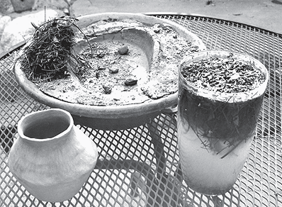
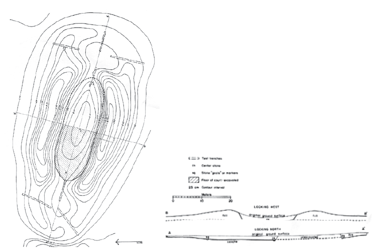
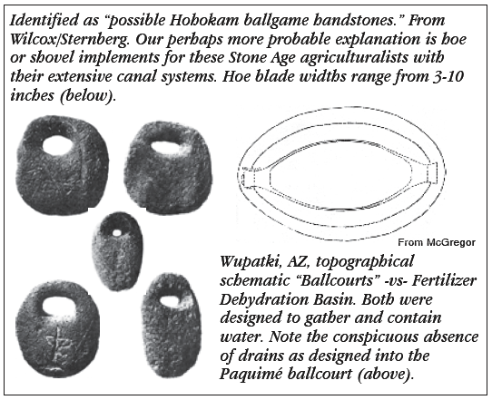
Characteristics of Fertilizer Dehydration Basin-Paquimé Slot
Catchment, Hohokam Oval Dish Catchment, Anasazi Masonry
Mulching Ponds At Woods Canyon Reservoir, Richard A Wilshusen notes there was extensive “clearing of this sediment and placement on top of the dam ... must represent an ongoing process, otherwise the catchment basin would have filled only with sediment ... the soil in the immediate area is of sufficient quality to germinate corn or beans .... vessel forms combined with the high percentage of white ware are quite appropriate for dipping water, transporting water a short distance, or excavating muddy sediments from the basin ... it is of course possible that the basin was used for agricultural purposes ... over 77 percent of all the sherds are white wares, and the predominant form is jars ... this is a very different assemblage than any other site in our experience ... finally, the extremely high percentage of white ware jars and relative paucity of gray ware suggests a specialuse site rather than a habitation site ... [at] Mummy Lake excavations, 86 percent are jar forms and 87 percent are white wares ... [Ponding] features such as Woods Canyon Reservoir, Little Cajon Lake, Goodman Lake, and Moqui Lake are not physically a part of a large site, although large potential Chacoera communities are usually within 2 km” - Wilshusen, Churchill, Potter.
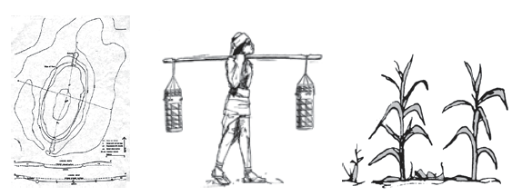
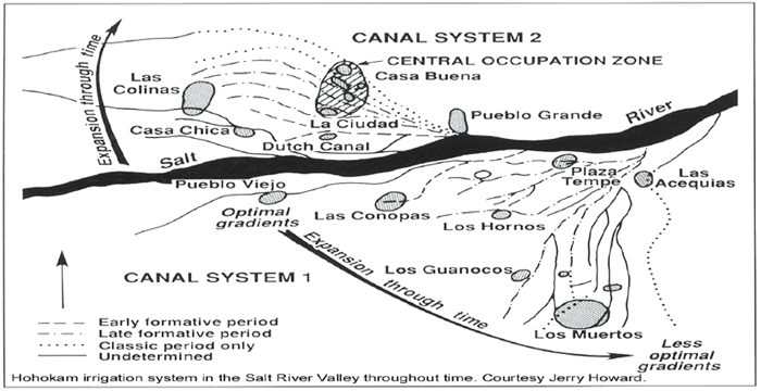
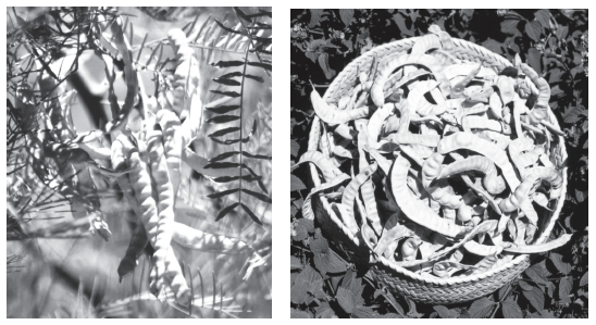
The Hohokam Canal System and Mesquite - The Hohokam canal system was probably built primarily for the cultivation of a mesquite bosque. It has been long questioned why the Hohokam built such an extensive system on one of the saltiest rivers in North America. Bean and especially corn cultivation is moderately to severely impacted by saline water and salinity. Mesquite is not impacted by levels of salinity found in the Salt River basin. My observation is that the Hohokam’s primary reason was to grow mesquite in the “delta” shaped canal system and mesquite conditioned the soil for corn and beans with nitrogen and shade temperature reduction, and moderated freeze sensitivity in the winter. Prosopis L. Mesquite, as described by Franklin T. Bonner, scientist emeritus USDA Forest Service, is a tree which is “a hardy nitrogen-fixer. Mesquite legumes make high-quality forage for livestock and wildlife, and the seeds were widely used by Native American peoples in the Southwest (Davis and others 1975; Marting and Alexander 1974; Vines 1960). The crude protein contents of honey and velvet mesquite seeds are 31 and 24%, respectively (Becker and Grosjean 1980), and the legumes of honey mesquite are high in carbohydrates (Harden and Zolfaghari 1988).” Professor Todd Bostwick said, “The Hohokam would have always faced the challenge of soil salinity, yet they farmed the same region for more than a thousand years, indicating that they understood how to deal with soil salinity — through the flushing of soils, leaving certain tracts fallow, alternating crop types planted, and other soil management techniques. Mesquite comprises approximately 50% of the archaeological record as compared to corn and beans.” While I agree with Professor Bostwick, my observation indicates that, from the archaeological record, the canal system was built primarily to “grow mesquite” for food, firewood, and building materials. Worldwide, especially in very arid climates, trees are grown as an agricultural crop, and the Hohokam were doing the same. Mesquite is a legume and as such it provides probably the “other” soil management technique used to add fertilizing soluble nitrates to the soils.
In interviews, neither Professor Bostwick nor Howard indicated
that the Hohokam used “grid gardens,” which have been
proposed as the primary agricultural design during that time
period elsewhere in Oasis America. I suggest that the Salt River
mesquite delta across the Phoenix Valley also functioned in such
a way as the salty water was used very little for corn and beans or
perhaps not used at all. The primary parasite for corn is root
cutworm and with very few hours below freezing each year,
gardens in the Phoenix Valley could perhaps have only been used
for a year or two maximum due to root cutworm infestations. I
propose that the strategy used by the Hohokam was to maintain
an extensive mesquite forest watered by the canal system and
that the gardens for corn and beans were moved throughout
the “delta” season to season.
Another factor to consider is that some of the canals are very
deeply incised. This would have put the irrigation water well
below any usable level for corn and beans, but would have been
ideal to water the deep taproots of the mesquite. |