|
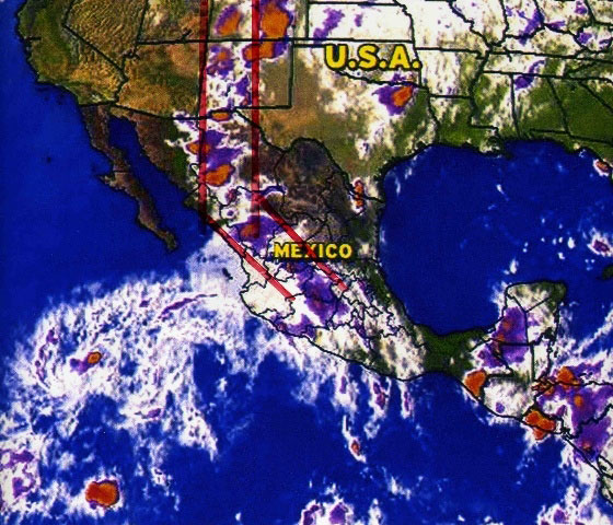
The “Chaco Meridian” is a natural rainfall event where summer monsoon
storms associated with lightning flow north along the continental
divide from central Mexico to southwestern Colorado. These thunder
storms are filled with measurable fertility originating in the tropics.
Richard D. Fisher points out that virtually all of the Chacoan as well
as Paquime Anasazi political systems are geographically located within
this Monsoon Meridian. He proposes that this natural phenomenon is the
basis of the “step fret” lightning pattern that dominates ceramic design
of those eras and is one of the fundamental foundations for Chaco-Paquime
religion. Additionally he points out that it appears that fertilizer is
the driver of these cultures. One aspect of naturally occurring fertilizer
is rainfall associated with lightning which has an easily observable and
strong positive effect on crops and agricultural production.
This satellite photo demonstrates that the Chaco-Paquime people were
responding to a natural weather pattern that was known to them. Perhaps
as the longitude 107.57 falls right in the center of this “Monsoon
Meridian” this is the reason for the alignment of Aztec, Chaco and
Paquime.
The research of Richard D. Fisher investigates the concept that these
Native Americans knew what they were doing and why. Respecting Native
American religion and culture provides the foundation for understanding
and interpreting these advanced ancient cultures.
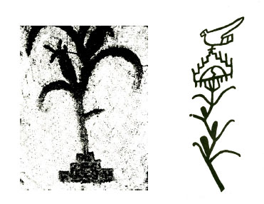
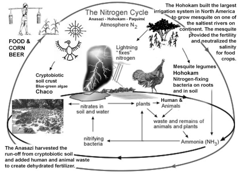
Two Anasazi symbols for fertilizer (above)
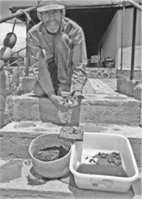
Anasazi / Mogollon / Point of Pines Fertilizer Components
consist of rainfall from lightening storms, cryptobiotic soil
and turkey manure baked in the sun. Potent!
|